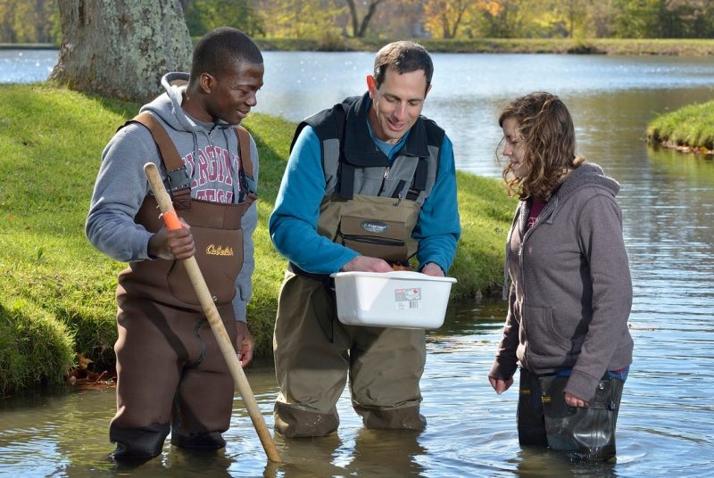
Forest ecosystem research team helps improve satellite data
Randolph Wynne, professor of forest remote sensing in Virginia Tech’s College of Natural Resources and Environment, has been selected by the U.S. Geological Survey and NASA to be a member of the Landsat Science Team. Wynne joins a team of scientists and engineers who will provide technical and scientific input on issues critical to the success of the interagency Landsat program.
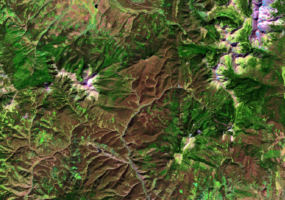
Landsat is a series of U.S. scientific satellites that have been imaging the Earth’s surface for 40 years.
“Landsat is a versatile tool that is used by farmers, scientists, and city planners,” said Matt Larsen, U.S. Geological Survey associate director for climate and land use change. “It’s used by a broad range of specialists to assess some of the world’s most critical issues — the food, water, forests, and other natural resources needed for a growing world population. This team will help the Landsat program reach its highest potential.”
Membership in the Landsat Science Team comes with funding for proposed research. “My research goal is to improve our collective ability to monitor, model, and manage the earth system — and, in particular, forest ecosystems — through improvements in both the preprocessing and analysis of multi-temporal Landsat data,” said Wynne, who serves as co-director of the Center for Environmental Applications of Remote Sensing.
“Since Landsat was first launched in 1972, we have gained an unparalleled view of the Earth’s surface,” he added. “That Landsat archive, which used to cost $500 to $600 per scene, is now publicly available for free. It is a sea change in the way we can use these data.”
A scene is an area measuring 185 kilometers (115 miles) by 185 kilometers. Virginia, for example, is made up of 15 slightly overlapping scenes.
“The advent of no-cost Landsat data enables an unparalleled increase in our understanding of the earth system,” said Wynne. “However there are gaps in our ability to morph Landsat sequences into periodic time series.”
His research will test different means to fill the gaps. “Every 16 days, we get a new picture of a scene from the satellite,” he continued. “But that doesn’t mean the data will be usable. For instance, there are clouds and cloud shadows. We are testing prototype solutions for getting rid of clouds.”
Wynne’s research team is using a common cloud removal algorithm to remove some of the clouds and shadows. Then they’ll test crowd sourcing, in which they post the problem online and invite people to bid to do the somewhat labor-intensive job of finding the remaining clouds in the images.
Research team members Professor Kevin Boyle and Associate Professor Klaus Moeltner, both of the College of Agriculture and Life Sciences’ Department of Agricultural and Applied Economics, are recruiting undergraduate students to fine-tune online training modules for cloud identification. They will also test undergraduates who have different levels of experience for this task to determine relevant experience and skill level, and look at the influence of pay scale on the quality of the final product.
Another technique being tested is to provide the missing image data using a Fourier regression — that is, by creating a model based on data from previous shots.
An important issue being addressed by Wynne’s research team is the ability to be alerted “on the fly” when there are significant changes to a landscape.
“Once a truly periodic time series has been generated, one of the most important questions in land use science is whether we can flag changes to land use and land cover at or near the time at which they occur,” said Wynne. “Whether the application is disaster management or agricultural productivity, urban expansion or forest loss, detecting these changes is critical to understanding a wide variety of earth system processes.”
Research team member Evan Brooks, an instructor in the Department of Forest Resources and Environmental Conservation, and his colleagues at Virginia Tech and Boston University have developed an approach that has proved capable of detecting even subtle changes, such as forest thinning.
“In a nutshell, once a periodic time series has been generated, statistical control charts, such as have been used for decades in industrial engineering, can be used to detect ‘out-of-control’ observations, which in this case represent change in surface material type or condition,” said Brooks.
Based on their past work, the researchers will use two control charts: one to detect large, sudden shifts, such as forest fires, and one to detect subtle, gradual shifts, such as forest thinning. Research trial areas are long-term forest productivity plots and actively managed industrial forests in Alabama, Louisiana, South Carolina, and Virginia.
“Our team of scientists has a wealth of practical experience in forestry applications of Landsat and other remote sensing data,” said Wynne. “We will help the Landsat program develop advanced methods or strategies for large-area land change assessments, pioneer new applications of Landsat data sets resulting from the free data policy, and increase the value of Landsat for addressing societal issues.”
Concerning applications to forestry, “We are asking whether multitemporal clustering, or scenes taken over time, help us look at forest growth,” he said. “For instance, if a forest was planted in 1988, can we use Landsat to monitor it? Because leaf area trajectory is related to productivity, we can tell where trees are growing well and where they are not.”
“The ability to do this is novel and interesting,” Wynne continued. “It allows us to look at site-specific information in a way we never could. For instance, we can help the landowner decide which area of their property might be particularly responsive to fertilization.”
The researchers are also trying to develop analysis techniques that will allow Landsat to be used to distinguish hardwood competition in pine stands.
“The experience of my research team members is essential, and the people from federal agencies and other universities on the Landsat Science Team bring individual expertise and create a synergistic relationship so that the science and the data are of high quality.”
In addition to Boyle, Moeltner, and Brooks, Wynne’s research team includes University Distinguished Professor Harold Burkhart, Professor Thomas Fox, Assistant Professor Valerie Thomas, and Research Scientist Christine Blinn from the Department of Forest Resources and Environmental Conservation, and John Coulston, supervisory research forester for the U.S. Forest Service’s Forest Inventory and Analysis Program.
Some of the team members will travel to Vandenberg Air Force Base in California to attend the February 2013 launch of Landsat 8, which will have several upgrades.
“A major upgrade is the move from a whisk broom sensor to a push broom sensor, where a long array of detectors is pushed along rather than using a scanning mirror,” said Wynne. “This is a big change because the sensor is over a particular point longer and there is a better signal-to-noise ratio. Landsat 8 will also have two new spectral wave length bands: one to identify high cirrus clouds and the other that is sensitive to changes in water quality.”
The Landsat Science Team is also working to jumpstart Landsat 9, “to ensure this valuable data stream remains available for the wide variety of applications that depend on it,” he added.
Wynne’s award from the Landsat Science Team is for $200,000 for the first year, renewable for four additional years, totaling almost $1 million.