Game day GIS application improves stadium security at home football games
A new Geographic Information Systems (GIS) application for event management was tested during the Virginia Tech Hokies home opener against Appalachian State, and after only minor tweaks and adjustments, the application is now being used at all home games at Lane Stadium.
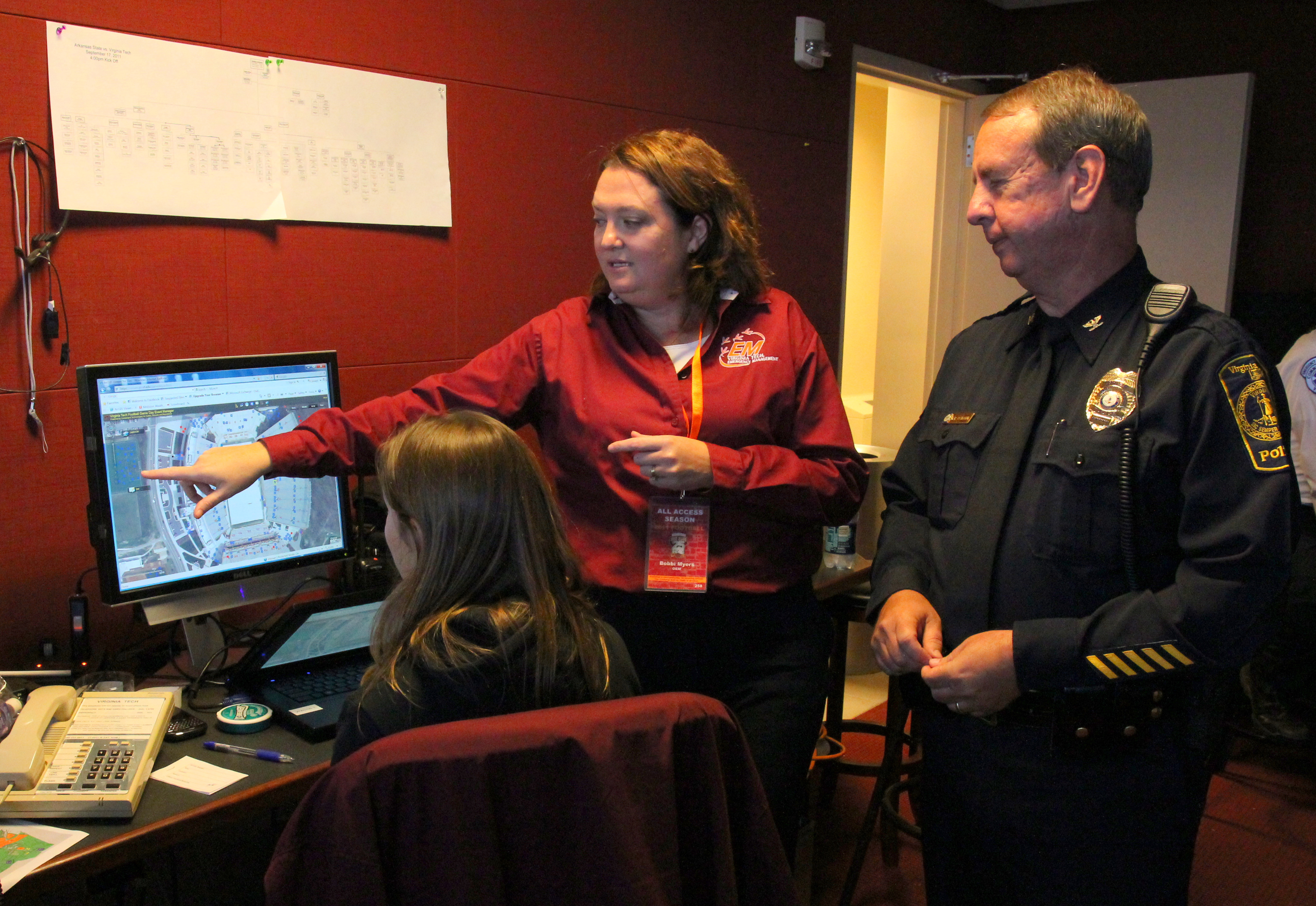
The application allows police and emergency responders to track and view security and safety activities digitally using a Web-enabled, spatial platform.
The map displays GIS layers for incidents, rescue squad and police resources, stadium seating location references, and interior space floor plans overlaid on top of an aerial view of the stadium and surrounding areas.
As police and rescue squad calls come into the stadium emergency operations command center, Bobbi Myers, an administrator in Virginia Tech's Emergency Management, inputs both reported incidents and the location of responders deployed to the scene.
Data points are immediately stored in the university’s Enterprise GIS system, from which they can later be used to analyze university response and plan for future events.
“As each game is unique, the application provides a picture of events as they happen, giving responders the information they need to identify problem areas and strategically redeploy assets in response to changing circumstances,” said Seth Peery, senior architect for enterprise GIS and one of four developers of the application.
Perry collaborated with Mahesh Narayanamurthi of Blacksburg, a graduate student majoring in industrial and systems engineering in the College of Engineering; Luke Ward, technology manager; and Richard Phipps, systems administrator, all working in the Department of Converged Technologies for Security, Safety and Resilience and reporting to the Vice President for Information Technology Erv Blythe.
“Each type of resource is referenced using a unique icon or color, and a legend provides a visual reference,” said Peery. “To prevent information overload and improve situational awareness during the event, these layers can be selected individually to appear on the map or to not appear as needed.”
The application also provides a search capability, enabling responders to enter an officer’s name and quickly pinpoint on the aerial image where that officer was last stationed. Because the time of each incident is recorded, responders can view the day’s unfolding events as a time-lapse animation, to help them better understand when, as well as where, “hot spots” of activity took place.
The application also can be easily adapted for use at other stadium events, not just football games.
“In past seasons for home football games, police and emergency responders used large paper maps in the command center and manually annotated resource positions and incidents of note,” said Brenda van Gelder, executive director of Converged Technologies for Security, Safety and Resilience. “The GIS application facilitates more efficient viewing and tracking of resources and responses, and also significantly enhances post-game analysis of safety and security events.”
As the season progresses, police will have a historical record of all the security and safety incidents from each game, along with the number of officers, emergency vehicles, and rescues that were needed.
Virginia Tech Police captains Joey Albert and Vince Houston participated in the development of the application, and were on hand at the Sept. 3 game to put it to use for the first time.
“The GIS application, which was very user friendly, made the task of tracking events and resources during the football games more efficient,” said Houston. “Tracking our resources is a critical component to ensuring public safety during the game which enables the unified command in the Emergency Operation Center to manage each event effectively.”
Dedicated to its motto, Ut Prosim (That I May Serve), Virginia Tech takes a hands-on, engaging approach to education, preparing scholars to be leaders in their fields and communities. As the commonwealth’s most comprehensive university and its leading research institution, Virginia Tech offers 240 undergraduate and graduate degree programs to more than 31,000 students and manages a research portfolio of $513 million. The university fulfills its land-grant mission of transforming knowledge to practice through technological leadership and by fueling economic growth and job creation locally, regionally, and across Virginia.